Create Preliminary PMP Cost Estimates — Accurately and Fast
MyRoads® is an online Pavement Management mapping application designed to give Public Works professionals the tools needed to streamline project selection and identify AC/PCC costs within the PS&E design process.
With MyRoads® you can:
- Perform PMP / PCI analysis
- Increase project selection efficiency
- Improve PMP reporting accuracy
A Cutting-Edge Cost Estimating Tool
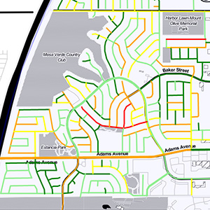
MyRoads® is a web-based dashboard designed to give insight into pavement management data by allowing users to query data dynamically, make selections via the interactive map tools, and build preliminary project scopes with the customizable cost estimator.
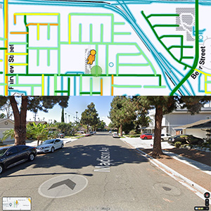
Users can add external GIS data sources to MyRoads® from ArcGIS Online — MUTCD signs, sewer manholes, storm drains, ADA pedestrian ramps, street striping, and more — and view each street at ground level through Google Street View.
Application Features
Data Visualization
View your pavement management data in an interactive map.
Filters
Apply filters to limit results by Network, Rank, PCI Range, or Zone.
History
View historic pavement survey conditions and work histories.
Reports
Generate and export custom PCI reports.
Interactive Selection
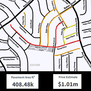
Make map selections to define project scopes.
GIS Map Layers
View GIS web services to add context to your data.
Cost Estimator
Generate fast project estimates with the customizable cost estimator.