What is GIS?
A Geographic Information System (GIS) is a framework for gathering, managing, and analyzing data. Rooted in the science of geography, GIS integrates many types of data. GIS reveals deeper insights into data — patterns, relationships, and situations — helping users make smarter decisions.
Understanding the client’s needs, expectations and budget
We take a common-sense approach when making software and hardware recommendations. Cities are often sold software packages that aren’t needed until the GIS is mature and a full-time GIS staff is present. We recommend a phased approach to building the GIS that lets the City invest as department needs are identified.
Advantages of a Geographic Information System
- Improve data quality and access
- Coordinate projects citywide
- Streamline common tasks
Data-Driven Decisions
Spatial analysis is changing the way the world works — letting you evaluate suitability and capability, estimate and predict, interpret and understand, and much more. GIS technology applies geographic science with tools for collaboration and understanding by incorporating relevant data to be analyzed spatially, so users can identify patterns, relationships and correlations and make better-informed decisions.
A Phased Approach
We recommend a phased approach to building a City Geographic Information System. It lets the City efficiently allocate funds and gauge accomplishments while getting the highest ROI.
Phase I
Publishing
The initial goal is to gather and assess all available datasets and publish them to a web-based mapping application such as ArcGIS Online. Users and web maps are set up to give City employees access to the data in an interactive map.
Phase II
Tools
Digitize simple datasets such as City Council Districts and Truck Routes. Data published in this phase is relatively fast and easy to create. Interactive map tools for Filtering, Measuring, and Public Notification are added.
Phase III
Growth
Digitize complex datasets such as Water, Sewer and Storm Drain Systems that require a large work effort. As the City GIS matures, hardware and software upgrades are advised as needed.
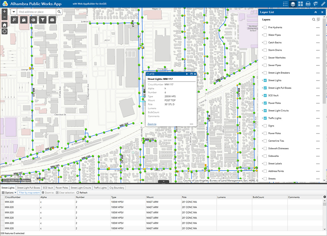
Sample ArcGIS Online Application
Common Managed GIS Datasets
- Aerial Imagery
- Parcels / Addresses
- Benchmarks
- Vacant Parcels
- Pavement Management Plan
- Water System / Fire Hydrants
- High Fire Severity Areas
- Electrical
- Sewer Systems / Manholes
- Zoning
- Land Use / General Plan
- Sphere of Influence
- Centerline Ties
- Signs
- Public Facilities
- Planning Commission
- Street Centerlines
- Street Lights / Circuits
- Street Sweeping
- Street Legends / Striping
- Street Moratoriums
- Curb Markings
- Truck Routes
- Parking Lots
- Fiber Optic
- Traffic Elements
- Trash Collection
- Sidewalks / Distresses
- ADA Ramps
- ABC Licenses
- Bus Routes / Stops
- Code Enforcement
- Trails
- Trees
- Contours
- Slope / DEM / Hillshade
- Easements
- HUD
- Environmentally Sensitive Areas
- HOA
- Capital Improvement Projects
- CDBG
- Elected Districts
- ROW Assessor Maps
- Tax Districts
- Overlay Districts
- Schools