Right-Of-Way Inventory
Over the past twenty years Bucknam has provided digital roadway imaging services to our clients. As cities mature with data management, GIS implementation and O&M, the ability to quickly, accurately and efficiently collect known street and right-of-way assets is a must. Our services allow our field technicians to collect GPS assets five times faster than current GPS hand-held technologies.
Not only that, the digital imagery that is utilized can be used again and again for numerous field collection projects (pavement + sign + catch basin + etc.) preventing your agency to issue four to five separate contracts. With one set of imagery, your agency will be able to collect other infrastructure assets in the future such as signs, catch basins and other ROW features; a tremendous costs savings.
Collecting numerous assets from “one set of imagery” allows our staff to survey all street and right-of-way assets through one pass along the street section. This methodology is an essential building block as your agency begins to build valid GIS/GPS infrastructure data, identify long-term management processes, and implements maintenance management programs.
Additionally, our staff can perform retro-reflectivity data collection during our sign inventory surveys or perform retro-reflectivity analysis on your existing sign database.
Our automated digital imaging allows our field vans and technicians to collect the following:
• Continuous imaging (images taken every 5 meters, competition typically surveys at every 8 meters/25 feet intervals)
• Imaging captures 100% of each pavement segment (not just one lane)
• Data transfers seamlessly to ESRI, Work Order and numerous infrastructure software’s
• Retro-reflectivity Services 2mm pixel images allows for centimeter horizontal and vertical accuracy
• Optional Ground Penetrating Radar (GPR) for arterials and collectors
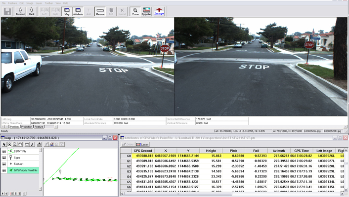
The survey process will involve the mobile GPS vehicle taking approximately two-week’s time to survey a street network of 400+ miles; additionally, the vehicles drive the posted speed limits. The images that are collected are taken by using Sony digital stereographic cameras (4 to 6 cameras) positioned on the vehicle. The images have a resolution of 2448x2050 and are geo-referenced by means of inertial GPS equipment contained within the van; images are taken every 4 to 6 meters, 15 ft. intervals.
The quality of the imagery and the GIS / record collecting capabilities within the software allows the technician to accurately identify the required sign assets/attributes defined by the scope of work.
Survey vehicles are equipped with digital measuring instrumentation (DMI) that will be used to verify all section lengths and widths. Our vehicles can be equipped with road roughness rating equipment, strip mapping cameras and are set to record 360 degree street imaging. The required inspections will be performed by the Bucknam team that is experienced and trained in asset collection and condition assessment using LambdaTech’s “Feature Extraction” software. Our staff has collected over 150,000 known assets for our clients.

